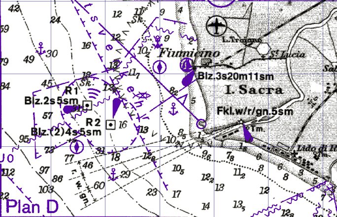
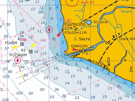
Notes: Our raster charts is produced by own technology. This is not simply scanned image. All charts is drawing manually with all details of a paper's original. Due to this they have quality of a vector charts
The image is built up of a large grid of tiny coloured dots (pixels), normally at resolutions of 100 by 100 dots per inch (or more). This is the fastest, easiest and least expensive way to create electronic charts and they are created by simply scanning the paper chart. Various reference information is then added so that latitude and longitude positions can be calculated. The resulting raster charts can then be reproduced on a computer screen with the appropriate navigation software. Because raster charts are basically a photograph of the paper chart all the information is shown on the computer screen exactly as it is on the paper, i.e. all the symbology is the same, the text is the same, the white border of the chart is present, etc. This can be an advantage (the electronic chart is immediately familiar and understandable to the user) or a disadvantage (the chart can not be easily manipulated) depending on the users requirements and needs. Zooming and panning is also generally limited with a Raster Chart since when zooming in for greater detail, the photographic image is simply magnified and no more detail can or will appear.
The advantages of raster charts are as follows:
-Faithfulness of reproduction. The electronic chart looks just like the familiar paper chart
-They are generally cheaper than the Vector charts
-The coverage is generally much wider than the coverage of Vector charts
The disadvantages are as follows:
-No information can be selectively removed or displayed at different zoom levels
-Generally raster charts are not easy to update Notes: Our charts are easy to update
-Raster charts are generally slower to display on the screen.
-Raster chart systems are generally more memory intensive and can take many megabytes to store the image of a single nautical chart. They are generally distributed on CD-ROM and therefore Raster chart systems normally require a CD-ROM drive.
Notes: Our charts has small size and can be distributed by Internet and stored on your hard disk
My charts have price 3.80 Euro for one chart in on-line shop and downloaded via Internet usually in next minute. Are some way for really reduced chart's prices - to buy chart's packs. Usually the price of one chart's in regional pack is 1.20 - 1.50 Euro.